Friday, September 5, 2014

Why adventure? North Sutor hike

Who is there that doesn't love an adventure?
Why do I love travel so much?
Why aren't I as willing to try new experiences at home as when traveling?

Adventures, big fan.
Getting lost, not a fan.
Start out with a plan. Read up on it, map it out, figure even a Plan B perhaps.

Then you start out.
If you get lost, oh well, see what fun things there are in the spot you landed.
If the restaurant is terrible, oh well, there must be an ice cream store around the corner.
If it rains, oh well, it's a day for reading and Qwirkle.
If we have to wait in a long line, oh well, time to take a deep breath, recharge, enjoy the ones you are with.

Need to bring this outlook back with me to non-vaca life.

Today was an adventure. 3 1/2 mile walk, but up 750 feet.  That's a high hike for me.

But not high marks for signage, as it turned out.
We were off course at one point, at the highest point, but we squeezed through a fence (on hands and knees) after half a mile to rejoin the footpath.


Parked next to ferry from Nigg to Cromarty. 
Walked past this randy rooster with his gaggle of hens. 


Up we go. First half of walk is on a single path private road. 
You see North Sea Oil Rigs in the Firth for repair. 


Well look who's going up the hill also!

Realize Mike read me part of an article this morning, that there's a problem in England... home gardeners don't want to kill the pesky snails on their plants, so they toss them over the fence into their neighbors' yard. Then the neighbors toss them right back. It has become quite an issue, it seems. 

Love these problems.

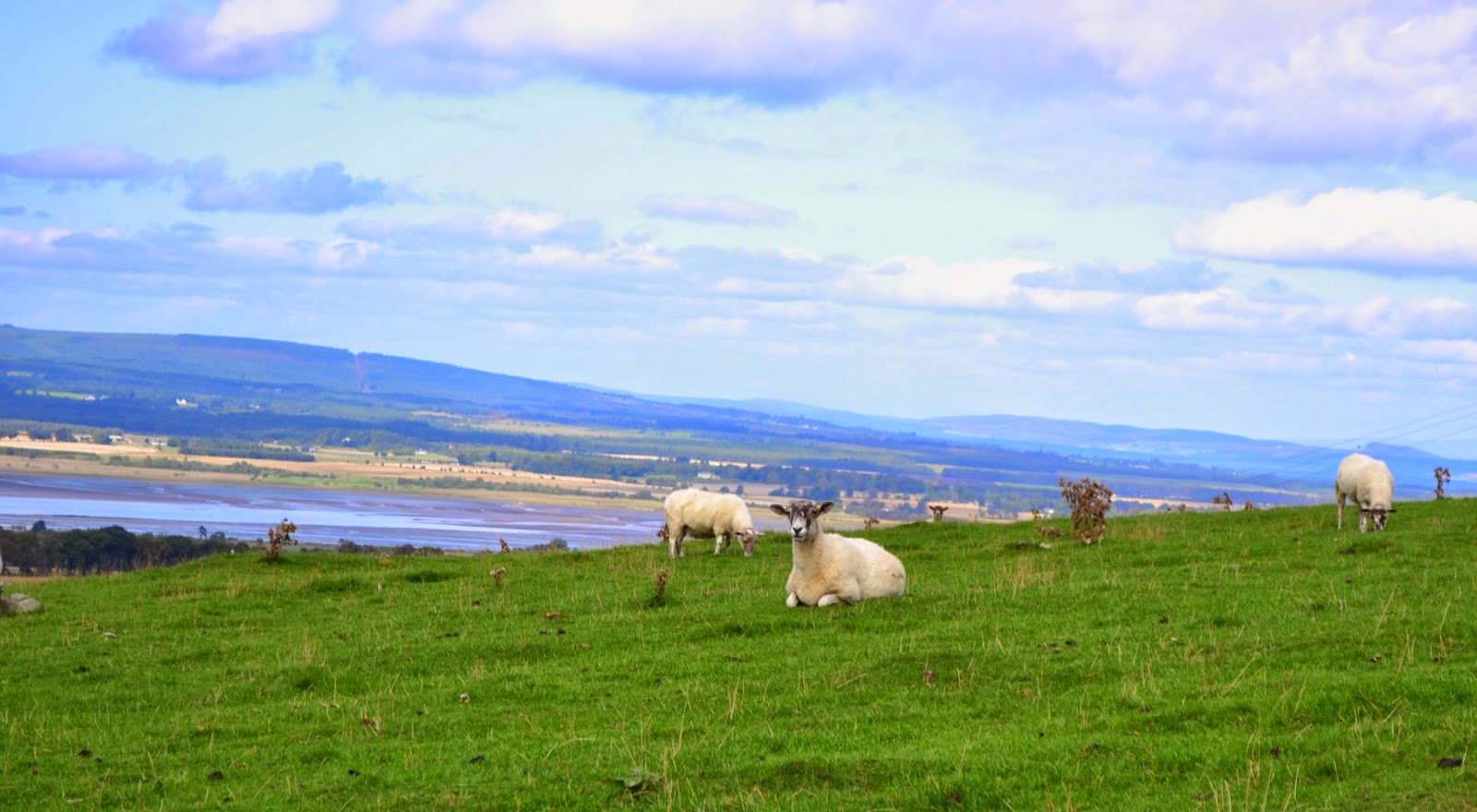
I started "baa-ing" at the sheep, so they would turn look at me. Better photos then. 


Mike prefers to ignore me when I am baa-ing. Here's a fellow hiker, who worked on building some of the port structure below in the 1970's.  Surprisingly, Mike let me continue up the hill, baa-ing. 


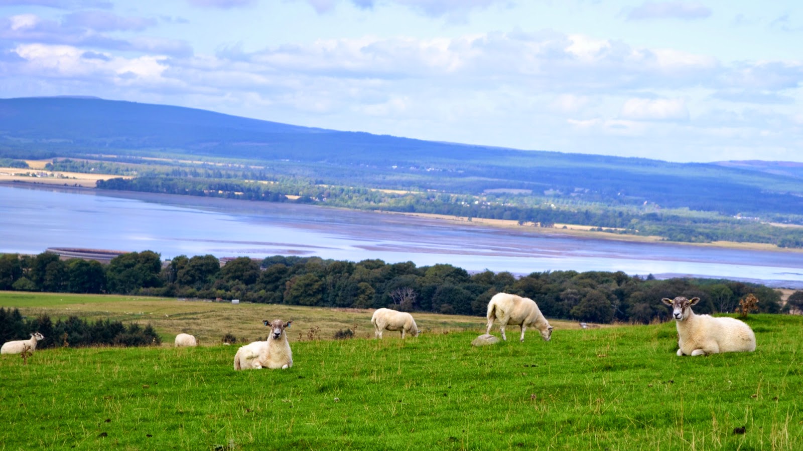
I return to my sheep. Note these guys sit with their backs to the stunning views.


Not these guys. They are taking it all in. 


Slowly walking further up the hill. 


This mini-herd really liked my baa-ing. Look at all those faces turned towards me. 
Don't know why others are ignoring me...

Further up the road, we turn right. 


Cows! What a great walk!


The big black one stared at us the whole way down this path. That's her outlined at the top of the hill. 


Looking down the hill.
This is where we got lost. I didn't take photos, which is too bad as this was a spectacular view in all directions... expansive meadows and on to the Firth.
But we were looking for the path.

Remember, all who wander are not lost. (Tolkien)
I admit. We were both.
Wandering and Lost.


But we crawled through the fence ( on the right) and rejoined the path! YEAH!


Spectacular.
That little dot you see just below the tip of the opposite peninsula is a boat!


Looking back at the ferry pier. 


A sign we didn't follow.


Whew we made it! 
Remember, Mike has walked 5 1/2 miles of golf this morning. He was never out of breath. 

Do you see the sheep in this photo below? They are on top of the hill on the right (where we were.) On the very top. 
They are tiny specks in this photo. 
Adventure is exhilirating. 


Thursday, September 4, 2014

Sheep, dogs and seals

The 2014 World Sheep Dog Trials are right now, in Fearn. Only 25 minutes south.
Let's go!

Last fall Mike and I sponsored Zorro at the Hailey Idaho Sheep Dog Trials. Zorro always looked fab to us, but didn't win a medal.  The trial format here is exactly the same.  Five recalcitrant sheep start out 700 yards away. The dogs have to run out, bring them to "present" them to the handler, then herd them through 3 sets of gates, them separate them into 2 groups, then herd them together again, then get them to run into a small pen. In about 10 minutes. In Idaho, we never saw a dog able to get the sheep into the pen. Here, they all did. These were amazing dogs. The handlers whistle, hoot, and wave their sticks. It is actually a cool thing to watch. Sheep and dogs. Does it get any better? 


And ice cream. Hand made toffee fudge ice cream. 


Drove home past Loch Fleet as Mike wanted to show me the exposed sand bars at low tide. We also saw about 50 seals lazing about on the sand bars!


Wednesday, September 3, 2014

Tarbet Ness on a spectacularly sunny day

Todd Warner, the Chicago banker who built the new and elegant Links House Hotel across the street said that when you turn off A9 onto the Evelix Road towards Dornoch, time slows down.

He is right. Time just flows more slowly here in Dornoch. I like that right now.

Royal Dornoch is closed for maintenance. So today Mike high-tailed it north 20 minutes to Brora, the course with cows, gulls and sheep on it. Some greens are surrounded with just plain wires strung 18 inches off the ground, to keep the livestock from roughing up the greens.

We have been playing Qwirlke alot. I think the overall score is 5-4.
We read.
And talk.
And walk.

This morning I got the notion to make the original King Ranch Casserole. Remember Lady Bird Johnson's? Except no cans of soup in it. Not much Mexican food up here. And I found a cappucino semi-freddo recipe from Nigella Lawson.

Photos posted today are of Tarbet Ness walk yesterday.

Vocabulary moment. A Loch is a lake. A Ness is a nose-like object. So Loch Ness is a lake with a projection resembling a nose? And Tarbet Ness is the pointy nose end of the peninsula.

Firth is a large sea bay. Dornoch Firth is bay of the North Sea between Dornoch and Tarbet Ness.

So these photos are of Tarbet Ness, and you look over the Dornoch Firth back at Royal Dornoch. Tarbet Ness has a lighthouse. Lots of photos in last year's blog entry.


Look who came out to greet us in the carpark!
Now, when you see these photos, realize this walk was sounds and textures as well as sights. 
Sounds of birds, cows mooing, sheep baaing, RAF fighter jets from Lossiemouth doing practice runs up high and skimming the ocean's surface. You hear them after they are past you, they go so fast so close. And you hear the sounds of the waves, the sounds of the rocks being swept in and back out of the wave channels. 


The textures. Walking on asphalt, then on the soft grass, hard rock, small pebbles, sand, heather roots, path worn bare. Gorse pricking your shins.


Hello Mike! 


I turn back to take a photo facing south, towards Lossiemouth...


And Mike walks out FARTHER!


I turn again towards Lossiemouth, the sun is spectacular on the water. And THERE'S MIKE! What a rock hopper. 


Fear of heights. I overcome my fears to bring you photos.
It is at least a 30 mile drop.
:)


Back to the carpark and our little red sedan.


Monday, September 1, 2014

Orkney ... including Skara Brae, Ring of Brodgar, Italian Chapel

Sunday we traveled to Orkney Islands, 6 miles north of tip of Scotland, reachable by ferry (or airplane.) We chose ferry from John O'Groats. Hired tour guide Kinlay of Orkney Uncovered to show us Orkney in 6 hours. Arrived south tip of Orkney in Burwick.

Highlights are Scapa Flow and Churchill Barriers (home of British Naval Fleet in WWI and WWII). Skara Brae (5,000 year old Neolithic Village of 10 families discovered in 1850.) Italian Chapel (built by WWII Italian prisoners) and Ring of Brodgar (27 of 100 standing stones 4,800 years old, in 300 foot circle... older than Stonehenge!)

Orkney is a neat collection of foodies who love living with vistas and history. It has the second highest per capita income in Scotland. Warmer than Dornoch (Gulf Stream.) I can see why people choose it as their home. I am sold.

National Geographic article on Skara Brae, the reason we traveled to Orkney.

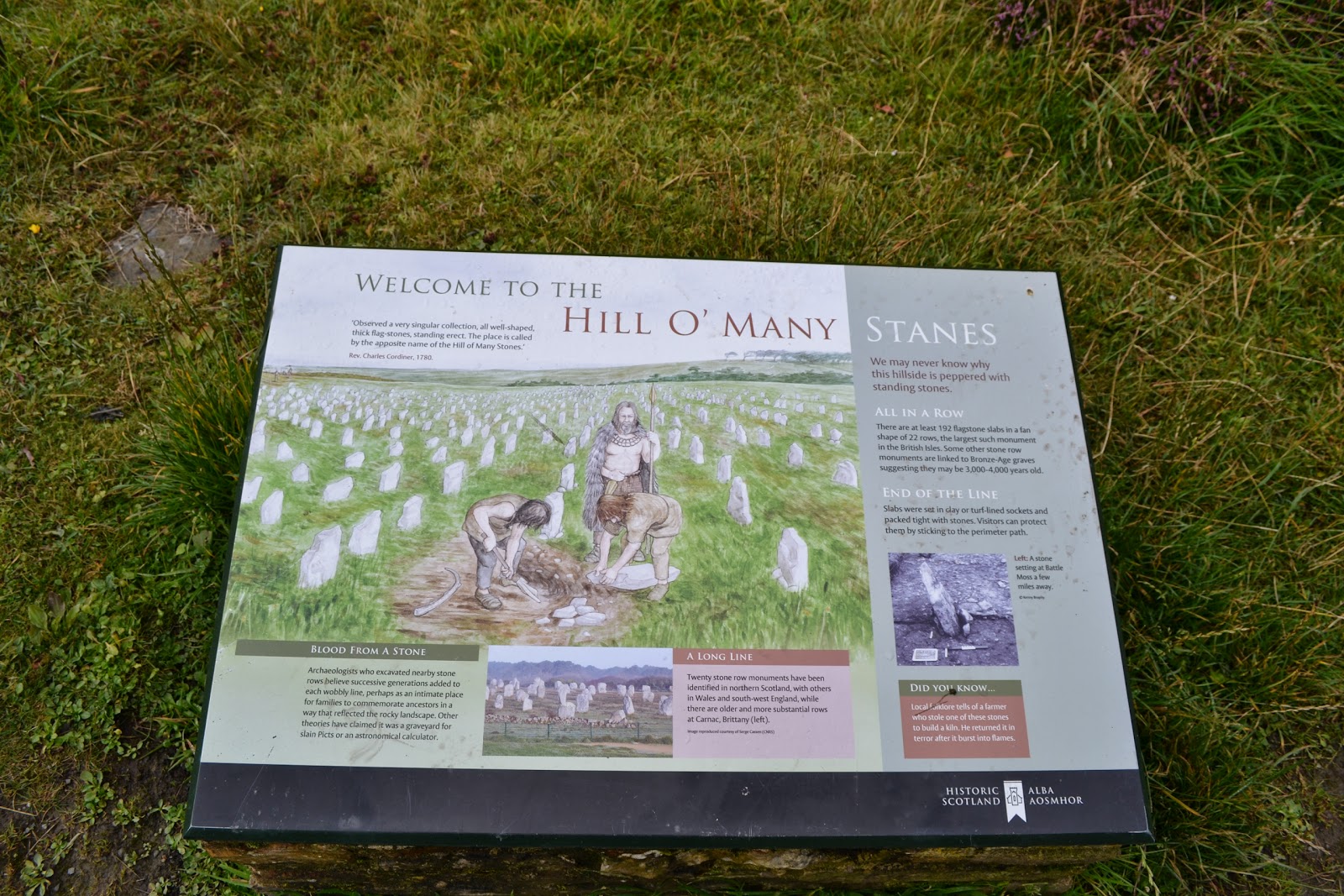
On the way, we zipped into a place I have wanted to zip into for 15 years, the Hill o Many Stanes. Neolithic site (5,000 years ago) in NE Scotland, a sixth of original left. What was it? Many guesses. Most likely stones marking families. Gorgeous 360 views over North Sea and grazing lands.


Then up to John O'Groats to catch passenger ferry to Burwick.


Approaching Orkney Islands.


Old but working farmhouse overlooking Scapa Flow. Scots have TONS of words for bodies of water. Scapa Flow is the body of water open to the Atlantic on west, North Sea on NE, but surrounded by about 8 small Orcadian (which means 'of Orkney) islands.  Only 100 meters deep, and sandy bottom. The world's second largest natural harbor (after Sydney), so it was used by fierce maurauding boaty Vikings from 900's on, and most recently by the British Navy... housed their entire fleet in WWI and WWII.


Scapa Flow - Churchill Barriers
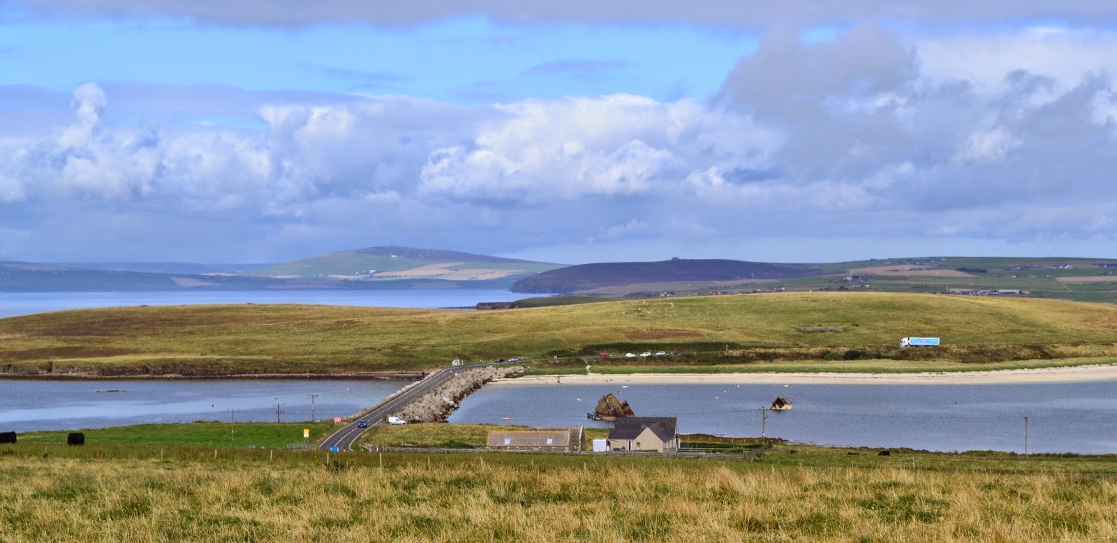
The first photo below is a Churchill Barrier. I think.  It is the bridge, which wasn't there at all at the start of WWII. A German entered Scapa Flow via these waterways between islands, in one of their infamous U-Boat submarines. Sunk a British battleship which they thought safe in this huge harbor.

So first the British scuttled a few of their own ships to block the passageways. You see two of those below. The U-Boats snuck in anyway, so they had their Italian prisoners-of-war from North African campaign build 4 Churchill Barriers - huge concrete blocks piled up as a solid dam between islands. They built roads over these Barriers. Prior to this, those 3 islands were approachable only by boat.


Italian Chapel
A testament to the indominatable spirit living inside each of us.
Front the front, a really eye pleasing little chapel placed on a peaceful hillside.

From the rear, you see it is really a long Quanset Hut with brick front entrance. The adorable white and red entrance you see above was built last, and finished three months before the end of the war.

Built by WWII Italian prisoners of war, who were here to build the Churchill Barriers.

Look what they did inside.
Remembering the beauty and elegance of chapels in Italy, they created what they could here in foreign Orkney. This chapel is made of materials they found up here in Orkney. The hanging lamps are from tin cans. The metal railings are scrap metal from ships. There is no stone relief inside on floor or wall. It is all painted.


Main artist was from Moena Italy. This heart inserted in the floor (that's a flat painted concrete floor) is to profess his love for a local Orcadian lass.


How they created the sanctuary of home for themselves.  Even in person, this looks like real marble walls, carved columns and reliefs. It is breath taking.  You really believe you are standing inside a chapel in the hills of Tuscany. Smell the rosemary?


My dear beloved friends, you know how much joy it gives me to post this photo.

Unfortunately my sheepy friend wasn't as interested in posing as I was in photographing.


So we walk off also. 

During the drive, we asked Kinlay about the upcoming Scottish Separation Referendum. He mentioned that one of the side's speaker was "about as useful as a chocolate teapot." It took me a minute, then I got it. HA!

Now about a thirty minute drive to Skara Brae. Neolithic. From 3000 BC. That's 5,000 years ago.
Older than Stonehenge. Older than the Giza Pyramids. Roman Colliseum.

We are back in the Stone Age.
Before Bronze, Iron, Steel.


First to the Skaill House property. Skaill is Norse/ Viking talk for Skull. Which is also what they say for their toast (cheers!) because the Viking maurauders would kill their enemy, clean out the skull, pour in their liquor, and raise a toast or a "Skaill." Lovely.

In the 1850's a blast of a storm unearths some stone buildings at Skaill House's shoreline.  Found out it was a Neolithic Village, 5000 years old, of 10 stone homes all connected.


  Walking out to Skara Brae. They have cool stones on the left of path, counting time backwards 5,000 years, in correct proportion.


That's out to the Atlantic on our right. Back 5,000 years ago, that was fresh water. The Atlantic has pushed its way in.

Temporary stone stacks all along beach. Can anybody say Andy Goldsworthy? (We were just at Storm King in NY in July.)


Our tour guide Kinlay grew up in Orkney. He remembers playing hide and go seek amongst these houses, as it was only made into a National Historic Trust Site in 1995.


Can you picture sitting on one of these stones, fire lit, smoky and warm, talking with your family member... what working hunting that day, do we need more animal skins, who will get the fresh water for dinner.

As you stand here, you start to see people down there, see the tools and items of their daily life, smell the hearth and the food cooking, hear them talking.  People are people.


Here below you can see another of the homes. In the center is the hearth. The roof would have been animal skins stretched over whalebone or wood, covered with turf. On the right wall is a set of stone shelves for storage. on the left wall is a bed, which would have used heather and animal skins for linens. The square box in front of shelves is a bait box, where they kept live bait. 

All this is not rennovation. This is the real 5,000 year old stuff.


They had a sewer drain from the homes into the ocean. This was 5,000 years ago!


In the coffee bar, this poem is mounted on the back wall. It portrays Skara Brae life, along with your imagination and the photos. Early 20th century poet.  Reading this after seeing the ruins of homes brought the people alive to me. Thank you to whoever placed this.


Orkney Fudge cupcake, Fudge tray bake bar, and a brownie. Keeping us tourists going.


So why keep antiquities? 
So we can learn and remember. 
We are just a grain of sand on the beach of eternity.

What is really neat is that 
each one of us is
a precious 
grain of sand. 


Now to the Ring of Brodgar. It is a henge (circular ditch) surrounding a circle of stones. From about 2400 BC.  

Slightly smalled than Stonehenge (Brodgar is 300 feet diameter, Stonehenge is 350 feet). Erected about the same time.  You see it on the hilltop from the carpark as you approach. 


Up we walk. 27 of the original 192 stones are remaining. So when they were standing, this was a ring of stones with 2 to 8 inch breaks between each stone and two entrances, north and south.


You easily see the henge here. Those two (yes he is in a kilt) are looking west out towards the Atlantic.

Does Easter Island come to mind?


No one knows what the true reason for these stones was. Kinlay's thought was defence. The location, no central altar, they were a solid wall of stones. Defence from the Vikings, the Picts, the anybody.

Standing up here, you feel the vistas. You feel the expanse of space. The sky is a slowly changing 360 panoramic backdrop. The feeling is openness, the intersection of earth and sky.

You could feel really insecure and minute.
Or you could feel expansive, connected and on top of the world.
Your choice.


So, Vikings were wild and crazy warriors. They would paint themselves bright colors, run screaming at the enemy swords drawn. They were 'beserkers', hence our word 'beserk.' Christians hired them to fight in the Crusades as mercenaries. Upon return, these Vikings would carve their name and a cross into stone to mark their victories.

Here's  Beserker Bjorn's Runic writing of "Bjorn +", from 1000's. This stone was lying flat, writing side down, and just upended recently to show writing.


  Then more grafitti appeared, here's a jumble from the 1800's - see J. Isbister 1881?


Running short on time. Stopped at 1200's St. Magnus' Cathedral. Inside, iron rings for British soldiers to tie up horses for safety, red sandstone pillars. 

And gravestones.
Many end with "Memento Mori"... Latin for "Remember Death"... as the final words from those gone, to us here still living.
Remember to live!


Wonderful day. Time does seem so fleeting when you think back 5,000 years.
What remains? Only those things we cannot see...


Orkney's flag


And the Scottish flag.